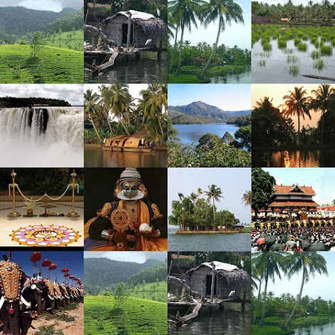
Alapuzha
ALAPPUZHA
(ALLEPPEY)
State:
KERALA
Country:
INDIA
Geographical
location
North
Latitudes : 9o 05' & 9o 54'
East
Longitudes : 76o 17' 30"& 76o 40'.
Architect
of modern Alappuzha : RAJA KESAVA DAS (1745-1799)

Carved
out of the erstwhile Kottayam and Quilon districts, Alappuzha(Alleppey)
district was formed on 17th August, 1957 and consisted initially of seven
taluks, namely Cherthala, Ambalappuzha, Kuttanad, Thiruvalla, Chengannur,
Karthikappally and Mavelikkara.
The name
Alappuzha is derived from the geographical position and physical features of
the place. It means the land between the sea and network of rivers flowing into
it. The district is bounded on the north by Kochi and Kanayannur taluks of
Ernakulam district, on the east by Vaikom, Kottayam and Changanassery taluks of
Kottayam district and Thiruvalla, Kozhencherry and Adoor taluks of
Pathanamthitta district, on the South by Kunnathur and Karunagappally taluks of
Kollam district and on the west by Lakshadweep sea.
The
present Alappuzha district comprises of six taluks namely Cherthala,
Ambalappuzha, Kuttanad, Karthikappally, Chengannur and Mavelikkara. Total area
of this district is 1414 sq. kms. The district head quarters is located at
Alappuzha.
Alappuzha
at a glance
District Head Quarters : Alappuzha (Alleppey)
No of Revenue Divisions: 2
No. of Taluks :6
No of Villages : 91
No. of Blocks :12
No. of Panchayats : 73
No. Municipalities : 5
No. of Assembly Segments : 11
No. of Parliament Segments :1 (Alappuzha + Part of Mavelikkara)
Demography
Area- 1,414 Sq.Km. which constitutes 3.64% of the total
state area.
The population size- 2,105,349 which is 6.61 % of the state
population.
Population density - 1492 persons per Sq.Km, against 1415 in
1991- retains the first position in the state.
Sex-ratio (No. of females per 1000 males) - 1079 , earning
4th position (5th position in 1991 with 1051)
Literacy Rate- 93.66 % which earns it the 3rd position in
the state.(State Average - 90.92%)
Female Literacy rate- 91.14 which again earns 3rd position
in the state.(State Average-87.86%)
Topography
The district is a sandy strip of land intercepted by
lagoons, rivers and canals. There are neither mountains nor hills in the
district except some scattered hillocks lying between Bharanikkavu and
Changannur blocks in the eastern portion of the district. Cherthala,
Ambalappuzha, Kuttanad and Karthikappally lie fully in low land region. There
is no forest area in this district.
CLIMATE
The climate is moist and hot in the coast and slightly cool
and dry in the interior of the district. The average monthly temperature is
250C. The district also gets the benefit of two outstanding monsoons as in the
case of other parts of the state.
Hot season - March to May
South-west monsoon (Edavappathi) - June to September
North-east monsoon (Thulavarsham) - October to November
Dry weather - December to February
The district has 8 reporting rain gauge stations at
Arookutty, Cherthala, Alappuzha, Ambalapuzha, Harippad, Kayamkulam, Mavelikkara
and Chengannur as recorded in 1989. The average rainfall in the district is
2763 mm.
GEOLOGY
The geological formations of the district are classified as
:
* a belt of crystalline rocks of the archean group
* a belt of residual laterite
* a narrow belt of warkalli bed of tertiary group
* a western most coastal belt of recent deposits
The most relevant crystalline rock type is Charnokites.
Residual laterite is the resultant product of the in situ alteration of the
crystalline rocks. Warkalli beds consist of a succession of variegated clays
and sand stone. The coastal belt consists of recent sediments like aluvium,
marine and lacustrine.
MINERALS & MINING
The two most important minerals which occur in large
quantities in the district are glass and foundry sand. Lime shell is exploited
commercially. High quality sand deposits occur between Alappuzha and Cherthala
which form a stretch of 35 Km in length along the western side of Vembanad
lake. Large quantities of sand are being mined at Pallipuram for manufacturing
sand lime bricks. Vast deposits of lime shell occur in Vembanad lake covering
an area of 15 Sq.Km. upto a depth of 8 metres between Pathiramanal and Vaikom.
China clay and ordinary clay which occur in various places are used as building
materials. The raw material required for granite carving is obtained from
Chengannur.
Boundaries
North – Kochi and Kanayannur Taluks of Ernakulam district
East – Vaikom, Kottayam and Changanassery Taluks of Kottayam
district and Thiruvalla, Kozhencherry and Adoor taluks of Pathanamthitta
District
South – Kunnathur and Karunagappally of Kollam District
West – Lakshadweep ( Arabian ) sea
Rivers
The district has a network of rivers,canals and backwaters.
Manimala, Pampa and Achancovil are the major rivers.
Manimala River
It originates from Mothavara hills in Kottayam district
enters the district at Thalavadi village in Kuttanad taluk and passes through
Edathua and Champakulam villages and joins the Pamba river at Muttar.The
villages of Manimala, Mallappally, Kaviyoor, Kalloppara, Thalavadi, Kozhimukku
and Champakkulam lie in the course of the river Manimala. It has a length of
91.73 Km and drainage area of 802.90 Km.
Pamba River
Pamba, the third longest river in Kerala is formed by
several streams originating from Peerumedu plateau in Idukki district, enters
Alappuzha district at Chengannur and flows through Pandanad, Veeyapuram,
Thakazhy, and Champakulam through a distance 177.08 Km and plunges into
vembanad lake through several branches such as Pallathuruthi Ar, Nedumudi Ar
and Muttar. The river has a length of 117 Km and is navigable to a length of 73
Km. The catchment area of this river is 1987.17 Sq.Km. The main tributaries of
the river are Pambayar, Kakki Ar, Arudai Ar, kakkad Ar and Kallar.
Achankovil River
This river often known as Kulallada river, originates from
Pasukida mettu, Ramakkal Theri and Rishimalai of Kollam district enters the
district at Venmony and has a catchment area of 1155.14 Sq.Kms and a marginable
length of 32.19 Km.It passes through Cheriyanad, Puliyoor and Chengannur
villages, enters Mavelikkara Taluk at Chennithala, flows through Thriperumthura
and pallippad villages and joins Pamba at Veeyapuram.

Back Waters
Vembanad Lake
The Vembanad lake, the most important of the west coast
canal system has a length of 84 Km and an average breadth of 3.1 Km. It covers
an area of 204 Sq.Km. Stretching from Alappuzha to Kochi it borders Cherthala,
Ambalapuzha and Kuttanad Taluks of Alappuzha district, Kottayam, vaikom and
Changanasserry taluks of Kottayam district, Kochi and Kanayannur Taluks of
Ernakulam district. Pamba, Achankovil , Manimala, Meenachil and Muvattupuzha
rivers discharge into this lake. Pathiramanal, often called the mysterious sand
of midnight, having coconut palms and luxuriant vegetation is situated in the
centre of this lake. Perumbalam and Pallippuram are the other islands in this
lake. The Thannermukkom regulator constructed across Vembanad lake between
Thannermukkom and Vechur is intended to prevent tidal action and intrusion of
saline water into the lake. It is the largest mud regulator in India.
Kayamkulam Lake
Stretching between Panmana and Karthikappally, Kayamkulam
lake is a shallow lake which has an outlet to sea at Kayamkulam barrage. It has
an area of 59.57 Sq.Km., a length of 30.5 Km and an average breadth of 2.4 Km.
It connects Ashtamudi lake by the Chavara Panmana canal.
Canals
Alappuzha has a network of canals included in the west coast
canal system which are used for navigation. The important canals are Vadai
canal, Commercial canals and the link canals between these two canals. Apart
from these, there are many inland canals which are mainly used for passenger
navigation and commercial purposes.
The lakes are used for inland water transport of passengers
and cargo. Inland fisheries have also been flourished in these regions.
Sea Cost
Alappuzha has a flat unbroken sea coast of 82 Km in length
which is 13.9 % of the total coastal line of the state. An interesting
phenomenon of this seacoast during the month of June is the periodic shifting
of mud bank popularly known as "Chakara" within a range of 25 Km in
Alappuzha-Purakkad coast due to hydrolic pressure when the level of backwater
rises during south-west monsoon.
BACKWATERS
One night cruise on the backwaters of the Alappuzha is one
of the most popular cruises offered. A round trip, in which you board the boat
at Alappuzha and disembark at Alappuzha after having spent the night in the
tranquility of the Backwaters.The cruise takes you through
the clear waters of the prominent Punnamada Lake – the venue of the legendary
Nehru Trophy Snake Boat Race. You can visit the 400 year old Champakkulam
church, one of the 7 churches established by St. Thomas. The Chavara Bhavan,
located 6 km from Alappuzha, is another interesting place that one can't affoed
to miss. The ancestral home of the Blessed Kuriakose Elias Chavara, the Chavara
Bhavan houses the legendary 250 year old beacon of light – preserved intact in
its original and primitive form.stars in a dark sky. Fishing women and men add
to the magic with their imaginative ways of fishing. Visit significant places
like the Ambalphuzha temple and the Champakkulam Church. The cruise from
Alappuzha to Kidangara takes you through the exotic backwaters to the Vembanad
Lake and the fascinating Pathiramanal Island.and other historically important
sights.
After spending the night at the romantic Vattakayal Lake,
you sail back to Alappuzha.
The Routes in Alappuzha
There are many interesting routes to cruise on the
Backwaters of Kerala, each route is more enchanting than the other.
Alappuzha to Alappuzha is a one night round about
cruise which takes you through the Legendary Punnamada Lake. Sail along the
gentle clear backwaters to the romantic Vattakayal Lake and spend a night
aboard.
Alappuzha to Kumarakom, a one night cruise which
offers you a magical night. Water birds – both residents and migratory adorn
the canals and water ways. The water lilies when seen in the night dazzle like
the twinkling
Alappuzha to Kottayam is one of the most exotic
Backwaters cruises. A cruise from Alappuzha through these backwaters tantalizes
you with its breathtaking serenity to remain as the most beautiful
reminiscences of your life. See the toddy tappers at work and farming done at
below sea level.
Alappuzha to Thottappally – a cruise of many
historical places.
Alappuzha to Mankotta – this cruise takes you through
the Punnamada Lake and provides you the opportunity of visiting the coir making
villages
Alappuzha to Alumkadavu – offers both a one night
cruise as well as a two night cruise. This cruise takes you to the place of
origin of the house boats you are traveling in – the Kettuvallams. Alumkadavu
is the place where entire clans used to make these Kettuvallams.
| |